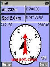
8Motions java app free download

 Name - 8Motions
Category - travelnavigation
Resolution - multi
Type - jar
Size - 264 KB
Rating - 2/5 from 70 ratings
| Rate this app: | |
| 1704 downloads | |
Description:
Ver v0.9.68 ML, for J2ME
With 8Motions, you can do the following things:
* Browse maps on your mobile. You can choose your map provider, between Google Map, Microsoft Live, Yahoo!Maps and ask.com
* See map or satellite picture
* Search for location, commerce
* Connect a GPS (internal or external through bluetooth) to get your current location. Perfect for N95 for instance
* Download "Maps" created by yourslef or other users
* Download KML files, GPX, or GeoRSS file
* Create and record tracks, that can be later uploaded to the web.
* Take geolocalized picture
* Post geolicalized notes/pictures on twitter (go to 8Motions website to setup your twitter account)
* Post geolicalized notes/pictures on flickr (go to 8Motions website to setup your flickr account)
* You can expend it and add more "layers" (called Mapz)
o OpenStreetMap
o Traffic
* use predefined extension:
o Flickr search
o Wikimapia
o "Velib" tools
* Can be linked directly to your Google "MyMaps" created maps.
Other features: Multilanguage supported, French, English and Russia for now (translator needed!) Ultra speed tile download Note: * this program make use of your data connection, so ensure that you have the right data plan to use it. * It was based and it's the evolution of "J2memap"

 Choose mobile
 Login
Login Signup


 Download directly on your phone by scanning this QR code